Maxar is a leading geospatial intelligence company.

We provide secure, precise geospatial intelligence, enabling government and commercial customers to monitor, understand and navigate our changing planet.

What We Do

Our unique approach combines decades of deep mission understanding and a proven defense and commercial foundation to deploy solutions and deliver insights with unrivaled speed, scale and cost effectiveness.

Barcelona, Spain as shown in Precision3D 3D Surface Model on the left, Precision3D Digital Surface Model in the middle and Precision3D Buildings on the right

Observing Earth

Maxar Intelligence’s capabilities help customers map, detect and predict change across the globe. Fueled largely by Maxar’s constellation of electro-optical satellites, we provide high-resolution satellite imagery and derived geospatial data layers, machine learning and rich domain knowledge so organizations can make decisions with confidence.

Explore the Maxar constellation
An artist’s rendering of a WorldView Legion satellite orbiting above the Earth.

WorldView Legion™

WorldView Legion is designed to meet our customers' evolving needs. WorldView Legion represents the best in space infrastructure for reliable Earth intelligence.

Explore WorldView Legion

Our Reach

You’ve probably seen—or even used—Maxar Intelligence capabilities, even if you didn’t know where they came from.

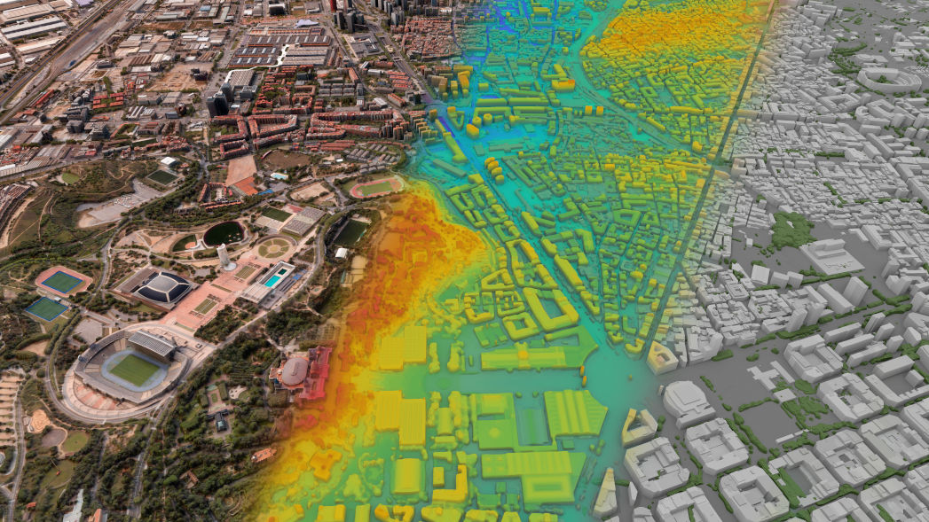
Maxar provides 90% of the foundational geospatial intelligence used by the U.S. government for national security and keeping troops safe on the ground.

Explore partnership

You may have seen our imagery on the nightly news. Media outlets leverage Maxar’s satellite imagery and analysis to provide transparency during global events.

See examples

Calling for a rideshare car? Using a map on your phone to find the nearest coffee shop? You’re probably using a map created with satellite imagery collected by Maxar’s satellites.

See how

By the numbers

Satellite image of Barcelona, Spain

85+

countries include Maxar Intelligence customers

125+

petabytes of data in our global satellite imagery archive

600+

software developers on staff

1,450+

cleared team members

2,600

employees

3.8+

million sq km of high-resolution imagery collected each day

Our Customers

Maxar is the indispensable mission partner of the U.S. government, providing satellite imagery and expert intelligence. Our solutions serve dozens of industries worldwide, from telecommunications and mapping to defense and intelligence.

Learn more

How Can You Contribute To A Better World?

Explore career opportunities at Maxar.

Find open positions
Photograph of Maxar’s headquarters building

Our leadership

The Maxar Intelligence leadership team brings together industry-leading experience and a relentless commitment to the success of our customers.

 Photograph of Quickbird’s launch in 2000

Making history

Maxar has a rich history of bringing together pioneers in the aerospace and geospatial industries to push the boundaries of what’s possible.

Stay Connected

Maxar blog

Subscribe for perspectives on the industry and our business.

Subscribe

In the news

Follow Maxar in the news.

Read news